
PE Postcodes for Utilities & Services in Peterborough and Surroundings
Introduction: The PE postcode area, covering Peterborough, parts of North Cambridgeshire, and surrounding regions, presents a mix of urban and rural living. Here, we delve into essential insights on water, electricity, and other crucial services available in the area.
Water in Peterborough
Where does the water supply come from in Peterborough and is there ever a shortage of water?
In Peterborough and its adjacent areas, the primary sources of water supply are the River Nene and underground aquifers. The River Nene, in particular, plays a pivotal role in providing for the region’s water needs, with treatment plants ensuring that water is safe and clean before distribution. Although Peterborough enjoys a relatively reliable water supply, it faces challenges such as seasonal variations, agricultural demands, and the impacts of climate change, which could strain water resources. Local authorities, like Anglian Water, implement measures to manage resources efficiently, including water conservation campaigns and infrastructure upgrades to cope with demand. Residents are encouraged to use water sparingly, particularly during dry periods, to help sustain the area's water levels.
What is the hardness & quality of the water in Peterborough and can this affect your health?
The water in the PE postcode area varies in hardness depending on the specific location, with areas closer to Peterborough generally experiencing harder water. This is primarily due to the geological composition of the region, with water passing through limestone and chalky areas. While hard water contains higher levels of minerals like calcium and magnesium, it is safe to drink and can contribute to dietary mineral intake. The quality of the water is rigorously tested and treated to meet stringent health and safety standards, ensuring it is safe for consumption and use. While some may notice scale buildup in appliances due to the hardness, this does not pose a health risk. Authorities continue to monitor and manage water quality, ensuring residents have access to clean and safe water.
Electricity in the PE Postcode Area
Where does the electric supply come from in the PE postcode area and what is the future of energy there?
The PE postcode area, including Peterborough and surrounding regions, receives its electricity from a variety of sources, including national grid connections to fossil fuel power stations and a growing number of renewable energy sites. The area has seen significant developments in renewable energy, with solar farms and wind turbines increasingly dotting the landscape, particularly in the more rural parts of the region. Local initiatives also promote the use of solar panels on residential and commercial buildings. The future of energy in the PE area is focused on sustainability and reducing carbon emissions, aligning with wider national and global goals. Efforts are underway to increase the share of renewable energy in the local mix, with projects related to wind, solar, and biomass energy. The region aims to improve energy efficiency, reduce dependency on non-renewable sources, and move towards a greener, more sustainable energy future.
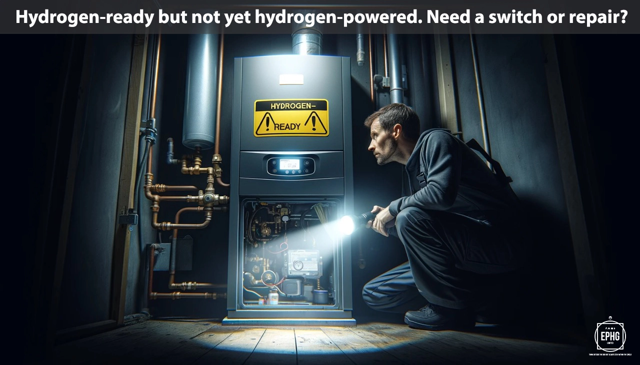
When is hydrogen coming to gas boilers in the PE postcode area?
The introduction of hydrogen to replace natural gas in boilers is part of a broader national strategy for cleaner energy, which the PE postcode area is preparing to adopt. While specific dates for a full transition are not yet fixed, pilot schemes and research into hydrogen technology are in progress. The shift towards hydrogen, seen as a vital step in reducing household carbon emissions, will occur gradually, paralleling developments in technology and infrastructure. Residents in the PE area are encouraged to stay updated with the latest advancements and are advised to consider energy-efficient measures for their homes in the meantime. Local authorities and energy providers will likely offer guidance and support as the transition approaches.
Where Does the Wastewater Go in the PE Postcode Area
In the PE postcode area, wastewater management is an essential public service, safeguarding both environmental and public health. Wastewater from residential, commercial, and industrial properties is collected and directed to treatment plants, where it undergoes comprehensive treatment to remove harmful pollutants. These plants, utilizing modern technology, ensure that the treated water complies with environmental standards before being released back into local watercourses, such as the River Nene and the River Great Ouse. The region’s commitment to effective wastewater treatment demonstrates its dedication to maintaining the natural beauty and ecological health of its waterways, contributing to the overall sustainability and well-being of the community.
Regions and Services:
The PE postcode area offers a wide range of environments, from the bustling city of Peterborough to the serene Fenlands and picturesque market towns. Key regions include:
- Peterborough City: The hub of urban utility development in the area, featuring advanced electrical, water, and gas infrastructure to support its growing population.
- Spalding, Holbeach, and Wisbech: Market towns with a blend of historical and contemporary services, reflecting their rich agricultural heritage and adapting to modern energy and utility needs.
- Stamford, Bourne, and Market Deeping: Historic towns where initiatives for renewable energy and sustainable living complement the traditional utility frameworks, enhancing their charm and resilience.

Regions within the PE Postcode
Peterborough and Surrounding Areas
- PE1: Peterborough City Centre, Eastfield, Eastgate, Dogsthorpe
- PE2: Fengate, Parnwell
- PE3: West Town, Bretton, Longthorpe, Netherton, Westwood
- PE4: Gunthorpe, Paston, Walton
- PE5: Castor, Ailsworth, Morborne, Thornhaugh
- PE6: The Deepings, Eye, Glinton, Northborough
- PE7: Yaxley, Farcet, Stilton, Folksworth
- PE8: Oundle, Barnwell, Titchmarsh
- PE9: Stamford, Ashton, Aunby, Bainton
Fenland and Northern Cambridgeshire
- PE10: Bourne, Bulby, Haconby, Hanthorpe
- PE11: Spalding, Deeping St Nicholas, Donington, Gosberton
- PE12: Holbeach, Fleet, Long Sutton, Sutton Bridge
- PE13: Wisbech, Guyhirn, Murrow, Parson Drove, Tydd St Giles
- PE14: Elm, Emneth, Friday Bridge, Outwell, Upwell
- PE15: March, Doddington, Wimblington, Manea
- PE16: Chatteris, Swingbrow, Pidley
- PE17: Ramsey, Ramsey Forty Foot, Benwick, Doddington
- PE18: Warboys, Bury, Ramsey Mereside
Lincolnshire Border and Coastal Areas
- PE19: St Neots, Eynesbury, Eaton Socon, Eynesbury Hardwicke
- PE20: Boston, Frampton, Sutterton, Kirton
- PE21: Boston, Fishtoft, Wyberton
- PE22: Butterwick, Benington, Leverton, Wrangle
- PE23: Skegness, Croft, Ingoldmells, Orby
- PE24: Skegness, Addlethorpe, Anderby, Chapel St Leonards
- PE25: Skegness, Seathorne, Winthorpe
- PE26: Ramsey, Bury, Upwood
- PE27: St Ives, Holywell, Needingworth
- PE28: Huntingdon, Kimbolton, Great Stukeley, Little Stukeley
- PE29: Huntingdon, Godmanchester, Hartford, Hinchingbrooke
- PE30: King's Lynn, North Wootton, South Wootton